Biogas project investment increased 40% in 2024, says the American Biogas Council. It found project growth continued last year, with the agricultural sector now moving faster than landfills in bringing facilities online. which means making bio gas from polluted water and creating large earth systems to ferment the organics into Bio gas.
Here is some information from the University of San Diego on super efficient cost effective bio gas system for all budgets. fermentation pits should be oversized to add incoming nutrients from landfill waste streams to maximize potential gas revenue. Ask us about our business plans custom made to your needs and growth.
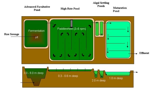
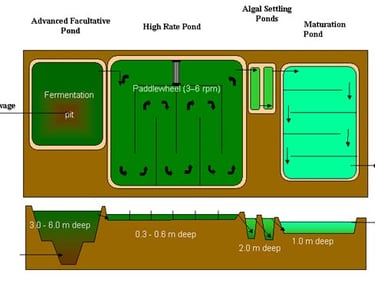
Pollution to Bio-gas
Dive Brief:
BioCNG is using biogas to fuel cars without putting it in a pipeline. With several systems in seven U.S. locations, the company is now building a $1.6 million facility for the Las Gallinas Valley Sanitary District near San Rafael, CA, to launch by the end of the year.
A $200,000 upgrade is also slated for Dane County Landfill in Wisconsin to increase storage, and over the next 10 years the county will convert most of its fleet to CNG, likely calling for further expansion of the BioCNG system. Overall, the Wisconsin State Energy Department reports that by the end 2014, 5,770 vehicles used 8.3 million gallons of CNG.
The system pumps biogas from a landfill or anaerobic digester. Volatile organic compounds and chemicals and carbon dioxide are then removed to create a clean CNG, which is piped a short distance to storage tanks and a fueling system.
Address
1 Great American River, San Diego
Hours
9 AM - 5 PM
Enhancing Watersheds for over 30 years
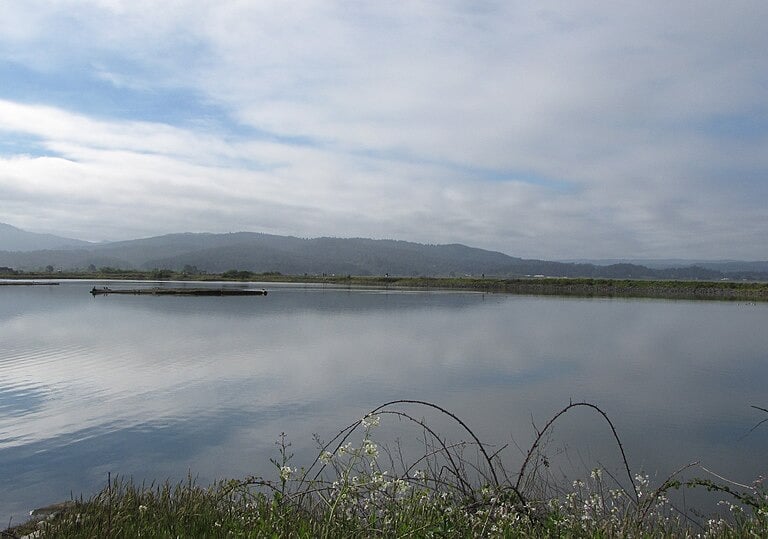
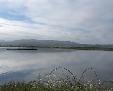
https://www.arcatamarshfriends.org/the-marsh/wastewater-treatment/
Ideas that use humans to solve pollution by creating jobs and a better more beautiful environment
We plan simply and effectively every time increasing biodiversity and reducing climate gas.
Bringing a new and better future for the worlds water needs through collaboration


Engagement
A hub for collaboration and watershed management updates and all your consulting needs.
Transparency
Collaboration
BenjaminCHittle@gmail.com
707-692-0789
© 2025. All rights reserved.